
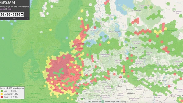
Crowdsourced maps such as GPSJam visualize where GNSS signals are degraded or denied. They are useful for awareness—but they have hard limits. This guide shows how to read them, what the shades actually mean, and where they fall short for operational planning.
What Is a GNSS Interference Map?
These maps aggregate reports from many receivers to estimate GNSS quality across regions. Areas with poor or lost fixes are shaded, giving a live picture of disruption hotspots. They answer a simple question: “Is GNSS generally reliable where I operate?”
How GPSJam and Similar Tools Work
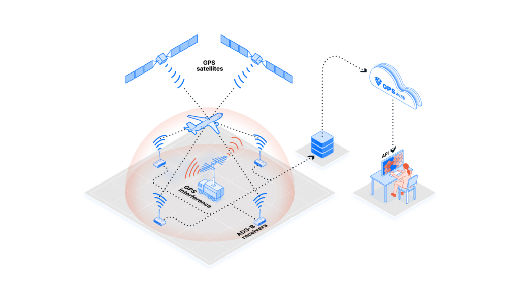
They rely on volunteer or transit data—often aircraft Automatic Dependent Surveillance–Broadcast (ADS-B) feeds—rather than dedicated sensors. A region turns “red” when many contributors report lost or degraded fixes. That makes them good at spotting large-scale, persistent denial, and useless for fine-grained, local detail.
Reading the Shades
| Pattern | What it usually means |
|---|---|
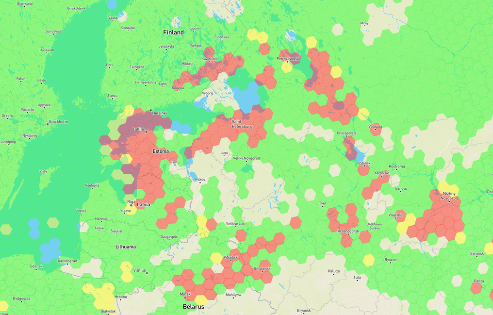
| Persistent red zones | Chronic jamming or spoofing near contested / conflict-adjacent airspace |
| Sporadic patches | Weather, terrain, or transient interference |
| Blank areas | No contributing data—not “clean” skies |
Confidence and Limitations
| القوة | Weakness |
|---|---|
| Free, broad regional awareness | Symptom only—not the cause |
| Good for large hotspots | Misses local / low-contributor areas |
| Directional trends over time | Lags reality; no spoofing/jamming distinction |
Maps show the symptom, rarely distinguish jamming from spoofing, and lag real time. Treat them as planning hints, not operational truth.
Operational Use: Where Maps Help and Where They Don’t
Use them to flag regions where you should assume contested GNSS and design for resilience regardless. Do not use them to decide “it’s safe today, so I can skip protection”—a blank square often just means no data.
From Awareness to Active Defense
Interference maps tell you where to worry—but they cannot protect you when you get there. They are passive, delayed, and blind to spoofing. True operational resilience requires active countermeasures at the receiver level, not just situational awareness.
If your planned routes or critical infrastructure sit within a persistent red zone, a standard GPS receiver will fail. Our adaptive CRPA arrays and multi-layer anti-jamming receivers are designed precisely for these environments:
- Spatial nulling instantly cancels high-power jammers from multiple directions while maintaining lock on authentic satellite signals.
- INS fusion ensures continuous navigation during temporary signal blackouts.
- مصادقة الإشارة rejects spoofing attacks that maps cannot even detect.
Instead of hoping the map turns green, equip your platform to fly, drive, or sail through the red. For on-site interference confirmation, refer to our detection guide. Contact our engineering team today to assess your threat exposure and deploy the right protection stack for your mission.
الأسئلة الشائعة
Q: Are these maps accurate?
A: Directionally, yes for large hotspots; precisely, no. They are awareness tools, not measurements.
Q: Do they show spoofing?
A: Indirectly at best. They mainly reveal lost or degraded fixes.
Q: Should I plan operations around them?
A: Use them for context, but design for contested GNSS regardless of the current shade.